
Hurricane Francine batters US state of Louisiana
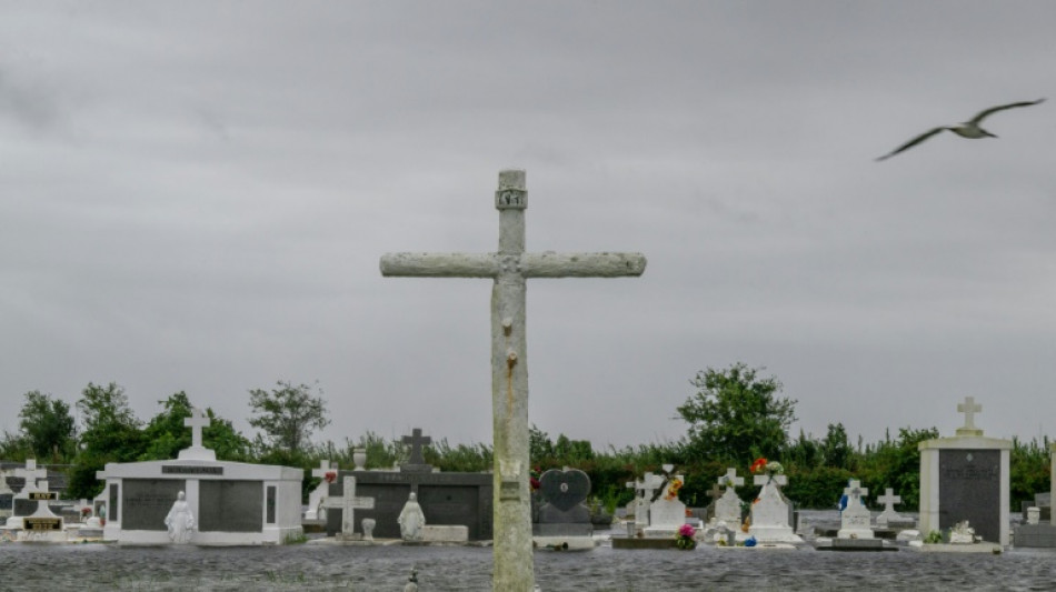
Hurricane Francine slammed into Louisiana Wednesday with potential for life-threatening flooding and storm surge as residents of the southern US state were advised to hunker down indoors.
The storm weakened as it moved over land, forecasters said, but it was still causing flooding, power outages and heavy rain and wind. A flash flood emergency was issued for the city of New Orleans.
Francine made landfall as a Category 2 hurricane on a five-level scale in Terrebonne Parish on the southern edge of the state at 5:00 pm local time (2200 GMT), according to the National Hurricane Center (NHC).
Two hours later the storm was downgraded to Category 1 with sustained winds of 85 miles (140 kilometers) per hour and could bring up to 10 feet (three meters) of storm surge and a foot of rain in some parts of Louisiana, the NHC added.
"Life-threatening storm surge, hurricane-force winds and heavy rains continue to affect southern Louisiana," the NHC said in a bullet at 0000 GMT.
The National Weather Service's New Orleans office issued a flash flood emergency for the city and nearby districts known as parishes, while New Orleans Mayor, LaToya Cantrell, urged residents to shelter in place.
"You need to be inside right now. Time to hunker down," Cantrell said in a video posted to social media.
Local TV stations and footage on social media showed coastal towns battered by the storm, with some streets flooded. More than 300,000 customers across Louisiana were without power, according to monitoring website poweroutage.us.
In the town of Houma, residents filled sandbags, stocked up on supplies and filled their cars with gas ahead of the storm's arrival.
"We're working hard to stay here as long as we can... to take care of our people," a gas station manager who gave her name as Alicia B. told AFP.
The NHC said the storm is expected to quickly weaken as it moves inland over Louisiana and neighboring Mississippi.
Louisiana Governor Jeff Landry has declared a state of emergency, and on Tuesday requested a federal emergency declaration from President Joe Biden, which he quickly approved.
The Louisiana National Guard said on X that its soldiers were fuelling up vehicles in preparation for the storm. On Tuesday, it said it was mobilizing helicopters, boats and supplies for evacuations and search and rescue.
Schools and universities around the capital Baton Rouge were preemptively closed until Friday, according to a government website.
Curfews starting as early as 6:00 pm local time (2300 GMT) were issued for communities across the Louisiana capital region, local media reported.
Low-lying Louisiana was the site of one of the most devastating hurricanes in US history, Hurricane Katrina, which killed more than 1,300 people as it slammed into populous New Orleans in late August 2005, overwhelming the city's levee system and causing extensive flooding.
At the mouth of the Mississippi River, Louisiana is a major US trade hub with a significant part of its economy linked to the oil and natural gas industry.
The 2024 Atlantic hurricane season, which began on June 1 and will end November 30, was expected to be busy but has seen just three hurricanes so far, reportedly puzzling scientists.
Hurricane Beryl became the earliest highest-level Category 5 storm on record after it formed in late June and plowed through the Caribbean, eventually hitting Texas and Louisiana, with dozens of deaths reported in its wake.
Scientists say climate change likely plays a role in the rapid intensification of storms because there is more energy in a warmer ocean for them to feed on.
G.Lomasney--NG
